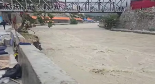
Following the recent massive avalanche in Mana, the Uttarakhand government has decided to conduct a comprehensive survey of potential obstructions in the upper regions of the Alaknanda and Pindar rivers. The survey aims to identify and mitigate any risks of water blockages.
Disaster Management Secretary Vinod Kumar Suman has formally requested the involvement of the Wadia Institute of Himalayan Geology, the Geological Survey of India (GSI), and the Indian Institute of Remote Sensing (IIRS). Additionally, the Public Works Department (PWD) and the Irrigation Department will collaborate on the survey.
Tragic Incident and Risk Assessment
On February 28, an avalanche in Mana trapped 55 workers, resulting in eight fatalities. Following the incident, concerns emerged about possible river blockages that could lead to future flooding. The government has taken proactive steps to prevent further disasters.
Also Read This – Liquor Sales Boost Uttarakhand’s Revenue, Excise Department Sets Higher Target
Three-Phase Survey Plan
- High-Resolution Satellite Imaging: Advanced satellite images will be analyzed to detect any obstructions in the river paths.
- Field Survey: Teams from the participating institutes will conduct on-ground inspections.
- Aerial Survey: Helicopters will be used for aerial assessments with support from the disaster management department.
The findings will help the government formulate effective measures to prevent potential floods and safeguard downstream regions.